


Wistlandpound to Barnstaple
The reconstruction of the railway between Wistlandpound and Barnstaple is part of our long term aims once the railway has been reinstated between Wistlandpound and Lynton.


The trackbed around the reservoir will require a new embankment and cutting The work to get round the reservoir is not considered particularly difficult in engineering terms and the project has been discussed with parties from South West Water and the South West Lakes Trust. The new formation will have to avoid the dam wall.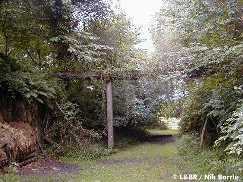

Beyond the dam at North Thorne, the trackbed will be at a higher level. It will then descend along this new formation parallel to the old trackbed, at a slightly steeper gradient until it rejoins the original trackbed at South Thorne, reaching the original level at around MP 9m 58ch. (just before Hunnacott).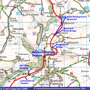
Image produced from the Ordnance Survey Get-a-map service. Image reproduced with kind permission of Ordnance Survey and Ordnance Survey of Northern Ireland.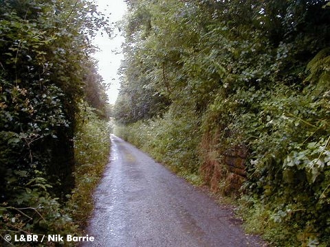

The trackbed from Hunnacott to Narracott is now a minor road. The proposal here is for a new road to be built alongside the trackbed so that the railway can be reinstated on the original formation.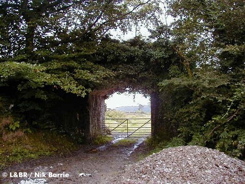
At Narracott a new road alignment will be needed to cross the railway as the road used to cross the railway by a now redundant, but still extant, bridge.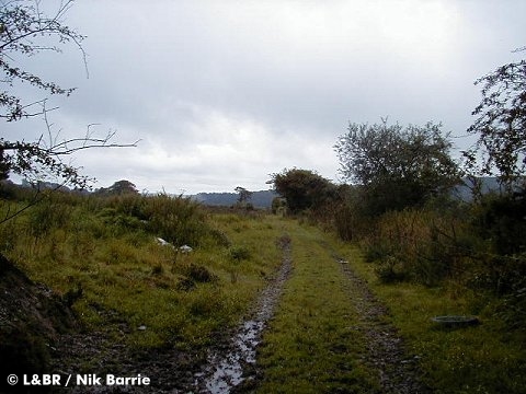

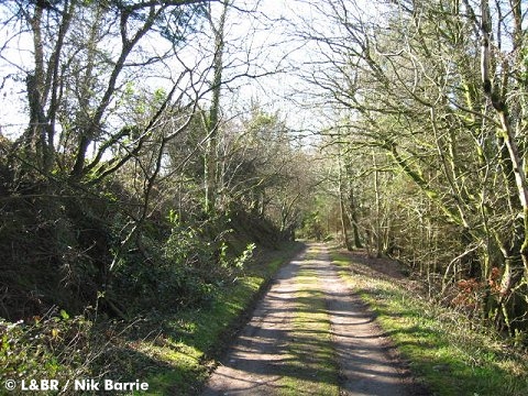
The trackbed is fairly clear from Narracott to Bratton, only a small bridge over the road at Knightacott needing reinstatement.
Between Knightacott and Bratton the trackbed has been well cared for.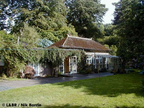
Bratton Station is little changed. Even the platform edges are mostly intact and the down name board posts still stand. The Goods Yard remains clear and the whole site is a delightful private garden which surrounds the station building.

As Bratton is the first place beyond Blackmoor/Wistlandpound that a passing loop could be installed, it is most likely that reaching Bratton would be the next major phase after the Lynton - Wistlandpound section.

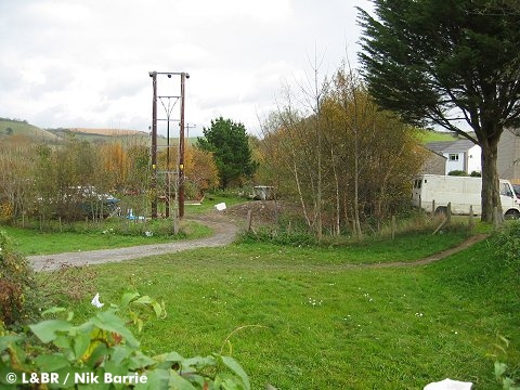
Beyond Bratton the trackbed passes through Holywell Woods which are being carefully managed with a positive approach to conservation, they also make for a delightful walk from Bratton Station Road along a public footpath.

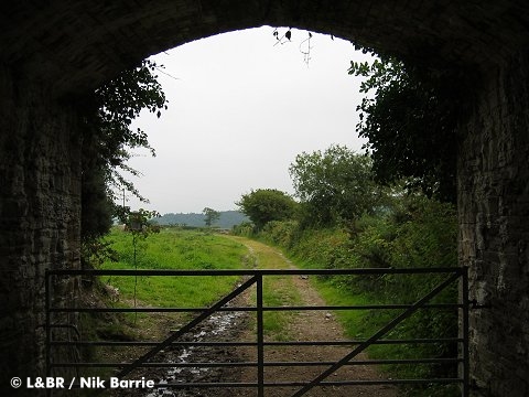
Although the trackbed is unobstructed several bridges are missing such as the one at Mill Lane (Pennyall) pictured above.

10 chains from Mill Lane is the site of Lancey Brook Viaduct which was completely destroyed as an exercise during World War 2. Fortunately the viaduct here was fairly low and small, in comparison to Chelfham!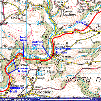
Image produced from the Ordnance Survey Get-a-map service. Image reproduced with kind permission of Ordnance Survey and Ordnance Survey of Northern Ireland.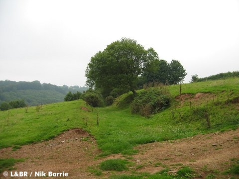

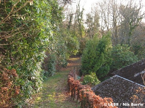
The formation meanders through the fields above Loxhore Mill as far as Chumhill and athough the trackbed remains unobstructed, careful negotiation will be needed to ensure this section is crossed in a manner that is satisfactory to the landowners.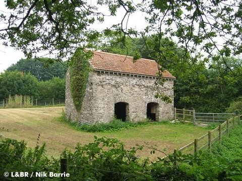

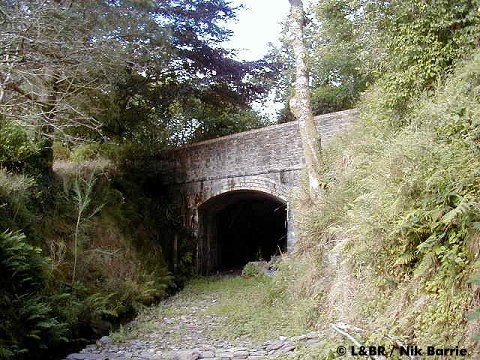
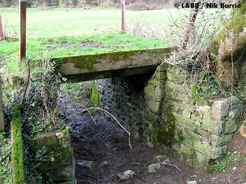
Beyond Chumhill is Bratton Cross Road Bridge. This bridge is still in good condition and carries the railway beneath the Bratton road which drops down to the valley floor.
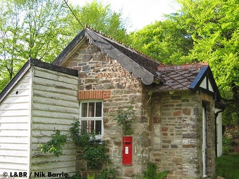
From here there is a clear run to Chelfham where the original station still stands, the station, trackbed and woodlands all now being owned by the railway. The station building is in very good condition and the whole station and site could easily be transformed back to its 1930's appearance.

The viaduct at Chelfham towers above the valley. Hardly suprising as it is the tallest narrow-gauge railway viaduct in Britain. At 70ft high and 132yds long, the eight arch structure is truly impressive.
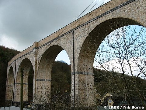
In 2000 the viaduct was completely restored by its then owners British Railways Board (Residuary) with assistance from the Railway Heritage Trust and the Lynton & Barnstaple Railway Trust.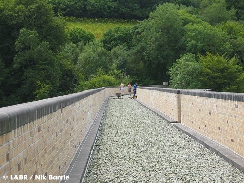
The viaduct now complete with proper drainage, parapet walls and ballast is ready to lay track over as soon as the railway reaches it!

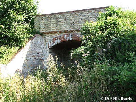
The Highway Agency currently owns the trackbed from the viaduct to Goodleigh Road. The bridge here will need some minor work, but remains sound.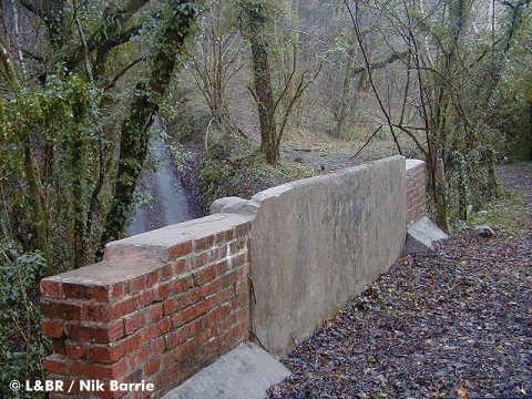

From Goodleigh Road the trackbed runs parallel to the road again on a ledge. Through Budds Wood the line is substantially clear with only a minor occupation bridge missing where the land ownership changes to an Exmoor Associates section.

Exmoor Associates owns the land either side of where the railway passes under the road. Realignment works and construction of a new bridge will be required here.
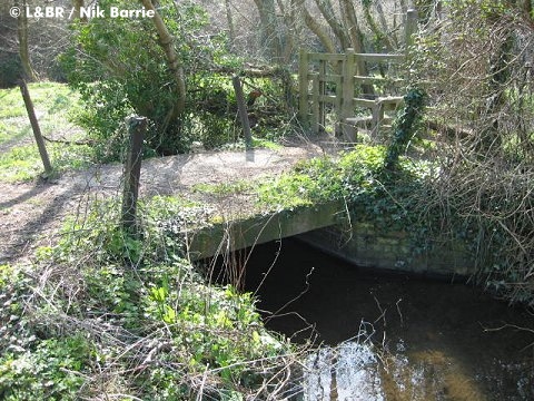
Once the road has been crossed, it is a clear run down into the Yeo Valley to Collard Bridge. The bridge has recently been restored by Exmoor Associates and Devon County Council.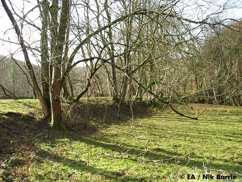

The bridges over the River Yeo here and at Blackwell have long gone, and new structures would need constructing in partnership with the Environment Agency. The trackbed traverses the current North Devon Scout Ground at this point. When railway construction eventually reaches this far south, we will have to discuss options with the landowners.

After here it is again a clear run to Snapper. It is along this section where L&B coach 15 was left in the field, eventually being rescued by volunteers from the Ffestiniog Railway, where it now runs in Wales as buffet coach 14.
At Snapper the trackbed runs immediately below the road in the valley, so it is not easily noticed from the car window. The halt, waiting shelter and platform still remain, and were obtained by Exmoor Associates in 2010, along with a long section of trackbed. The undergrowth was cleared and the shelter restored during 2011. Access onto the road now from the station gate is probably a little more risky than in the 1930s due to the increased speed of passing traffic.

From Snapper the railway passes below Yeotown and follows a relatively clear route through the fields until it reaches another missing river bridge. A small occupation bridge over a private road is also missing at Stoneyard.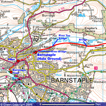
Image produced from the Ordnance Survey Get-a-map service. Image reproduced with kind permission of Ordnance Survey and Ordnance Survey of Northern Ireland.
Beyond the missing bridge (No.10) over the Yeo, the formation reaches the fringes of Barnstaple. Passing along the lower edge of the cricket ground and alongside the meandering river, eventually we reach the final missing bridge at Raleigh Weir which also marks the extent of the tidal section of the Yeo river and estuary.
Raleigh Weir bridge would make another great vantage point for photos of passing trains - it would also carry the formation onto the last remaining clear section of trackbed before the town.

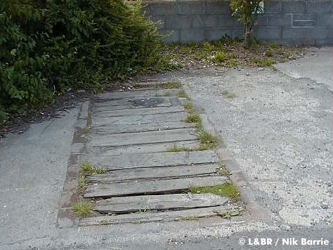
From Hole Ground, the trackbed runs to Derby Lane bridge - still intact, (above left) although the cutting on the townside is completely filled in and covered with car parking spaces and a play area.
From here to Pilton Yard (above right) surprisingly, is still clear, albeit some of the gardens have encroached onto the formation. If there was a will and need to return the railway to Pilton, and the local authority supported such plans, this could be reinstated without the need for excessive engineering work.
Pilton Yard is completely clear and now used for car parking. The old L&B railway offices still stand and could one day make a good museum building at the Barnstaple end of the line.
Beyond Pilton the trackbed has been heavily redeveloped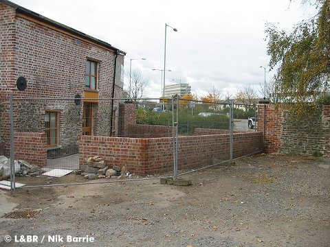

The gate post caps still in situ at Pilton Crossing. The crossing itself is now a mini roundabout.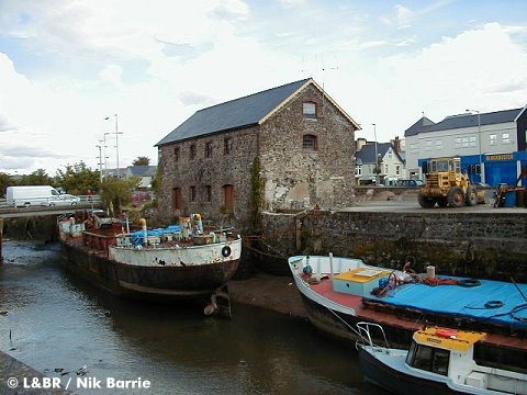

Gould's Yard and Rolle Quay still remain. The council's Civic Centre stands on the trackbed at the curve into town station, with a car park and retirement apartments occupying the site of the Town Station platform. A plaque on the wall marks the site of the end of the line.
Barnstaple itself is a thriving community, with a hub of shops, restaurants and places for entertainment. The town has benefited from construction of the western bypass, and the square a major facelift. Future development is likely to see even more construction - the arrival of a railway to the Raleigh / Pilton side of town could be part of it's future regeneration.
Exmoor's Award Winning Railway

![]()
![]()
L&B News
![]()
You search online - others will donate!

Join the 100 Club
![]()
Members

Latest Update:
18th October 2022
Member
![]()
We are listed on


![]()
Corporate Supporters - Where to Stay
![]()
![]()

![]()
![]()
![]()
![]()